
2021 Garmin Bluechart G3 Vision Relief Shading Review and Comparison (Gulf of Mexico)
2021 Garmin Bluechart G3 Vision Relief Shading Review and Comparison (Gulf of Mexico)
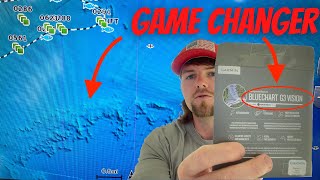 I received my Garmin G3 Vision chip today and wanted to show you all what it has to offer and if its worth getting it VS its competitors such as CMOR, Strikelines, etc…since they do not support Garmin chart plotters. I bought the New Orleans to Tampa, Fl chip because the area covered is where I fish out of, but they also have chips that cover other areas as well. If you Found this information helpful or learned something new please hit that like button for me and consider subscribing if this is your first time, Thankyou for the support!
Here’s a link to where you can find the G3 vision card used in this video
https://www.thegpsstore.com/Garmin-Bluechart-G3-Vision-Tampa-to-New-Orleans-Chart-VUS012R-P1772.aspx


Been considering this but wanted to know how much detail it shows 100 miles or so out of Anna Maria, FL (S of Tampa). I think they use the data from NOAA which doesn’t seem to have much for offshore in this area. Can you verify this on your system? Thanks
Hey I learned a lot I have the 8616 I will order one thanks
Do you know if you can run the g3 charts and strikelines at the same time?
Does this have good coverage for 20 miles and in for Panama City beach? Looks real good
Do you leave the vision card in ? What about the 32 g card for active captain?
I always wondered about this upgrade for my Garmin now I’m getting one for sure
How is this one different from the G3 Ultra?
It seems to be useful for picking up structure on the bottom offshore. I do a decent bit of reef fishing in my 22 so that would be useful. Does it help at all with inshore showing bottom contours or oyster banks? I know it has certain features that are supposed to help you navigate safely if you put in your draft. The tides in SC change a lot. Do you know if it changes the navigation line based on the point of the tide you hit it in or if it is based just off the chart numbers? For instance at high tide I can run nearly any creeks, but at dead low I may have to take a much longer trek. Just didn’t know how detailed the G3 vision was for inshore stuff
Have you tried the Garmin Steady Cast Heading Sensor? I’m not sure how useful it is for offshore applications. I’m thinking about adding one to the bass boat.
do you have one for the gulf of Maine and if you do does it show structure close to shore I’m running strike lines now but cant see structure till you get off shore a bit
Hi Capt. Collier, I live in Daphne Al and we are going out this Thursday for our first time to grouper fish. By chance do you know if the spot you have marked hills on your map hold any grouper? Any help would be appreciated!!! Thanks and keep making your videos for us to watch!!!
THANKS FOR SHARING!!!!!! THUMBS-UP!!!!!!!
Hi Capt. I purchased my chart for the keys and it has areas blurred and I feel like it doesn’t download for detail. Is there anything you would suggest to do, I feel like it isn’t loading correctly
Great info man, the details are amazing!
Just ordered new echo map UHD 94sv with g3 vision card for my area.
I have an echomap 74sv now but it won’t support the detailed maps so pulled the trigger
Great my friend ❤❤❤
Thanks for sharing!
Great info… I dont think my Garmin unit came with that relief shading
Will it work on Larance?
That is some really good detail. How does it look closer in at like the Southeast Banks or over off the West End of Dauphin Island?
Nicely done , thanx.
Buen día amigo, dónde puedo ver una vista previa para ver cuál es mejor
Thanks for sharing this,I think ima get this
Thanks for video, I am getting one today
Fantastic video, can I ask what transducer you are using?